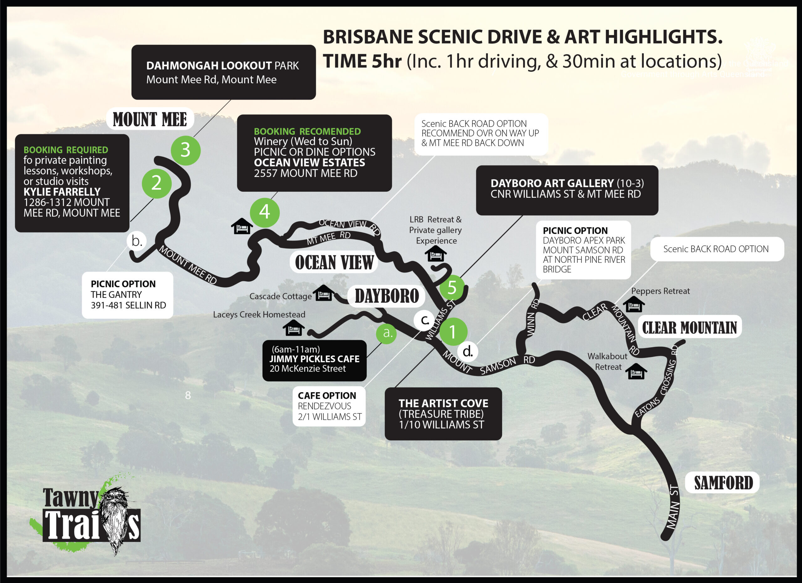
Begin your Tawny Trails day with a relaxed pre-trail coffee at Jimmy Pickles (open from 6am), then ease into the journey at 10am with a welcoming gateway stop at Dayboro Art Gallery — your map, bearings, and first taste of what’s to come.
By late morning, pause to breathe it all in at Dahmongah Lookout Park, where sweeping views across the Glass House Mountains invite a moment of stillness before lunch. At noon, settle in at Ocean View Estates for a scenic winery lunch (self-booking recommended), with alternative picnic spots and café options marked on the itinerary for those who prefer a lighter stop.
The afternoon returns you to art and conversation at the Dayboro Art Gallery, exploring works that range from classic to abstract and sculptural. The day concludes on a personal note at Kay Philp Private Studio, where botany studies and delightfully quirky faces offer a thoughtful, memorable finish.
Unhurried, welcoming, and rich with connection — this itinerary invites you to discover, linger, and enjoy the creative heart of the region at your own pace.
GETTING HERE
3 ways to get to Tawny Trails: • From North via Mount Mee Rd off the D’Aguilar HWY • From East Via Dayboro Rd (nice option to visit lake Samsonvale Via Vores Rd). coming from the M1 get off at the Dohles Rocks Rd exit • From South take Samford Rd (nice option is detour via Clear Mountain Road for sweeping views over the lakes)
Use Itinerary with digital interactive map below or
Right click printable map above & save to your files,
Open the saved file & press print
If you find you have extra time visit the main trail map to see what else is around you